


TcpGPS app for iPhone and iPad
Developer: Aplitop
First release : 12 Feb 2014
App size: 3.21 Mb
INTRODUCTION
This application allows to the user to make surveys using integrated GPS with its nominal precision, in a fast and easy way.
It can be used by surveyors and other technicians for surveys consisting on measuring lots, paths, crops, pipes, electrical lines, urban furniture...
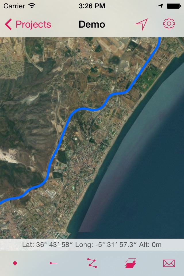
Apple Maps is used as background, and can be represented in standard, satellite, hybrid and relief modes. Geographic or UTM projected coordinates are shown at all times.
POINT SURVEY
The application allows data collection of single points, whose coordinates are got from the GPS, showing the estimated precision by a circle, as is usual in location-based programs.
The points are automatically numbered, recording date and time, and can be separated in different layers. User can also enter point codes, choosing them from a quick list.
CONTINUOUS SURVEY
It is also possible to perform a continuous survey, recording vertices automatically by an interval of time, distance or height difference.
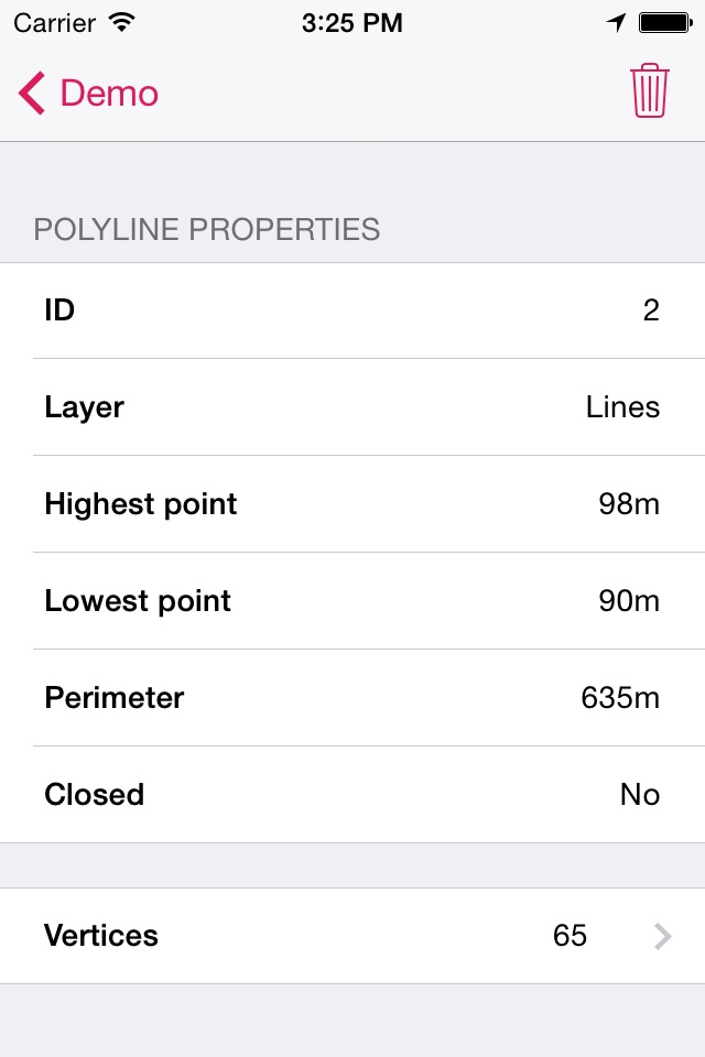
At any time you can view the polyline data, such as minimum and maximum heights, length and area. Vertex information can be displayed as well.
You can work with multiple layers, with different names and colors.
RESULTS
Survey can be exported to a KML file, that can be sent by email from the app. This file can also be imported by TcpMDT and other CAD and GIS applications.
SETTINGS
Editing preferences lets you to change the appearance of map, points and lines captured. It also sets parameters for data collection, information displayed in real time and others.
REQUIREMENTS
• Operating System: iOS 7 or higher
• Integrated GPS
• Internet access